
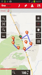
Map viewer, track logger.
You can use OruxMaps for your outdoor activities (running, trekking, mountain bike, paragliding, flying, nautic sports, etc.)
Some permissions explained:
1.-SEND_SMS: For new SOS feature.
2.-GET_ACCOUNTS: For secure login in OruxMaps servers.
3.-READ_CONTACTS: For fast friend selection.
100% free
100% no advertisements
Online and offline maps. Support to multiple formats:
-OruxMaps format. You can use maps from Ozi Explorer transformed with a PC tool.
-.ozf2
-.img garmin (vectorial) - no full support is provided.
-.mbtiles
-.rmap
-.map (vectorial from mapsforge). Support to custom themes similar to Locus themes.
Support to Wms, you can use the application as a WMS viewer.
3D view.
Support to multiple external devices:
-GPS bluetooth.
-Heart rate monitors, bluetooth Zephyr, Polar (including bluetooth smart devices, like polar H7).
-ANT+ (speed, cadence, heart rate, distance, etc.).
-AIS information systems (experimental), for nautical sports, using Wi-fi or bluetooth.
More features:
Support to KML, KMZ and GPX formats.
Share your position with your friends, display the position of your friends on your device.
Download online maps for offline use.
Text to speech support.
Profiles; save your preferences on your SD card.
Statistics with graphics.
Follow routes, with different alarms to alert you if you are near a waypoint, or you are far from the route.
Create/save waypoints, attaching photo/audio/video extensions.
Custom waypoint types, with your icons.
Basic support to Geocaching.
Correct the altitude of your tracks/routes using DEM files (offline) or online services.
Search/download tracks from:
-everytrail.com
-gpsies.com
Search or create tracks offline using Broute app.
Upload tracks to:
-mapmytracks.com
-trainingstagebuch.org
-ikimaps.com
-wikirutas.com
-openxplora.com
-strava.com
-openstreetmaps.org
Live tracking using:
-mapmytracks.com
-okmap application
-gpsgate protocol
More info here: www.oruxmaps.com
Map viewer, pista logger.
È possibile utilizzare OruxMaps per le attività sportive (corsa, trekking, mountain bike, parapendio, volo, sport nautici, etc.)
Alcune autorizzazioni spiegato:
1.-Send_SMS: Per nuova funzione SOS.
2.-GET_ACCOUNTS: Per l'accesso protetto a server OruxMaps.
3.-READ_CONTACTS: Per la selezione veloce amico.
100% gratis
100% senza pubblicità
Online e offline mappe. Supporto per più formati:
-OruxMaps Formato. È possibile utilizzare le mappe di Ozi Explorer trasformate con un tool PC.
-.ozf2
garmin -.img (vettoriale) - senza il supporto completo è fornito.
-.mbtiles
-.rmap
-.map (vettoriale da mapsforge). Supporto per temi personalizzati simili a temi locus.
Supporto a Wms, è possibile utilizzare l'applicazione come un visualizzatore WMS.
vista 3D.
Supporto per più dispositivi esterni:
bluetooth -GPS.
monitor della frequenza -Cuore, Bluetooth Zephyr, polari (compresi i dispositivi intelligenti bluetooth, come polare H7).
-ant + (Velocità, cadenza, frequenza cardiaca, distanza, ecc).
sistemi informativi -ais (sperimentale), per gli sport nautici, tramite Wi-Fi o Bluetooth.
Ulteriori caratteristiche:
Supporto ai formati KML, KMZ e GPX.
Condividi la tua posizione con i tuoi amici, visualizzare la posizione dei vostri amici sul vostro dispositivo.
Scarica le mappe online per l'utilizzo offline.
Text to speech supporto.
Profili; salvare le preferenze sulla scheda SD.
Statistiche con la grafica.
Seguire percorsi, con diversi allarmi per avvisare l'utente se si è in prossimità di un waypoint, o siete lontani dal percorso.
Creare / salvare waypoint, allegando estensioni foto / audio / video.
tipi personalizzati waypoint, con le icone.
supporto di base per Geocaching.
Correggere l'altitudine delle tracce / percorsi utilizzando file DEM (offline) o servizi online.
Ricerca / scaricare i brani da:
-everytrail.com
-gpsies.com
Cerca o creare tracce in linea con Broute app.
Carica le tracce a:
-mapmytracks.com
-trainingstagebuch.org
-ikimaps.com
-wikirutas.com
-openxplora.com
-strava.com
-openstreetmaps.org
Live tracking tramite:
-mapmytracks.com
applicazione -okmap
protocollo -gpsgate
Maggiori informazioni qui: www.oruxmaps.com
