
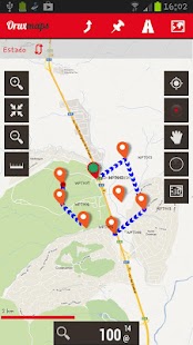
Map viewer, track logger.
You can use OruxMaps for your outdoor activities (running, trekking, mountain bike, paragliding, flying, nautic sports, etc.)
Some permissions explained:
1.-SEND_SMS: For new SOS feature.
2.-GET_ACCOUNTS: For secure login in OruxMaps servers.
3.-READ_CONTACTS: For fast friend selection.
100% free
100% no advertisements
Online and offline maps. Support to multiple formats:
-OruxMaps format. You can use maps from Ozi Explorer transformed with a PC tool.
-.ozf2
-.img garmin (vectorial) - no full support is provided.
-.mbtiles
-.rmap
-.map (vectorial from mapsforge). Support to custom themes similar to Locus themes.
Support to Wms, you can use the application as a WMS viewer.
3D view.
Support to multiple external devices:
-GPS bluetooth.
-Heart rate monitors, bluetooth Zephyr, Polar (including bluetooth smart devices, like polar H7).
-ANT+ (speed, cadence, heart rate, distance, etc.).
-AIS information systems (experimental), for nautical sports, using Wi-fi or bluetooth.
More features:
Support to KML, KMZ and GPX formats.
Share your position with your friends, display the position of your friends on your device.
Download online maps for offline use.
Text to speech support.
Profiles; save your preferences on your SD card.
Statistics with graphics.
Follow routes, with different alarms to alert you if you are near a waypoint, or you are far from the route.
Create/save waypoints, attaching photo/audio/video extensions.
Custom waypoint types, with your icons.
Basic support to Geocaching.
Correct the altitude of your tracks/routes using DEM files (offline) or online services.
Search/download tracks from:
-everytrail.com
-gpsies.com
Search or create tracks offline using Broute app.
Upload tracks to:
-mapmytracks.com
-trainingstagebuch.org
-ikimaps.com
-wikirutas.com
-openxplora.com
-strava.com
-openstreetmaps.org
Live tracking using:
-mapmytracks.com
-okmap application
-gpsgate protocol
More info here: www.oruxmaps.com
Map Viewer, Track-Logger.
Sie können OruxMaps für Ihre Outdoor-Aktivitäten (Laufen, Wandern, Mountainbike, Gleitschirmfliegen, Fliegen, nautischen Sport, etc.)
Einige Berechtigungen erklärt:
1.-SEND_SMS: Für neue SOS-Funktion.
2.-GET_ACCOUNTS: Für den sicheren Login in OruxMaps Servern.
3.-READ_CONTACTS: Für eine schnelle Freund Auswahl.
100% kostenlos
100% keine Anzeigen
Online- und Offline-Karten. Unterstützung für mehrere Formate:
-OruxMaps Format. Sie können mit einem PC-Tool verwandelt Karten von Oziexplorer verwenden.
-.ozf2
-.img garmin (vektorielle) - keine volle Unterstützung vorgesehen ist.
-.mbtiles
-.rmap
-.map (VECTORIAL von mapsforge). Unterstützung für benutzerdefinierte Themen ähnlich wie Locus Themen.
Unterstützung Wms, können Sie die Anwendung als WMS-Viewer verwenden.
3D-Ansicht.
Unterstützung für mehrere externe Geräte:
-GPS Bluetooth.
-Heart Rate Monitore, Bluetooth Zephyr, Polar (einschließlich Bluetooth intelligente Geräte, wie polar H7).
-ANT + (Geschwindigkeit, Trittfrequenz, Herzfrequenz, Distanz, etc.).
-ais Informationssysteme (experimentell), für Wassersport, mit Wi-Fi oder Bluetooth.
Mehr Funktionen:
Unterstützung für KML, KMZ und GPX-Formate.
Teilen Sie Ihre Position mit deinen Freunden, zeigen Sie die Position Ihrer Freunde auf Ihrem Gerät.
Laden Sie Online-Karten für die Offline-Nutzung.
Text-to-Speech-Unterstützung.
Profile; Speichern Sie Ihre Einstellungen auf der SD-Karte.
Statistiken mit Grafiken.
Folgen Sie Routen mit verschiedenen Alarme Sie zu warnen, wenn Sie in der Nähe von einem Wegpunkt, oder Sie sind weit von der Strecke.
Erstellen / Speichern von Wegpunkten, Anbringen Foto / Audio / Video-Erweiterungen.
Benutzerdefinierte Wegpunkttypen, mit Symbolen.
Grundlegende Unterstützung für Geocaching.
Korrigieren Sie die Höhe Ihrer Tracks / Routen mit DEM-Dateien (offline) oder Online-Dienste.
Recherche / Download Tracks von:
-everytrail.com
-gpsies.com
Suchen oder erstellen Tracks offline Broute App.
Laden Sie Tracks:
-mapmytracks.com
-trainingstagebuch.org
-ikimaps.com
-wikirutas.com
-openxplora.com
-strava.com
-openstreetmaps.org
Live-Tracking mit:
-mapmytracks.com
-okmap Anwendung
-gpsgate Protokoll
Mehr Infos hier: www.oruxmaps.com
