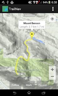
Find your way in the back country with this navigational tool. View maps, place markers, plan routes, view elevation and speed profiles, search for routes and markers, and record your movements across the land.
- Enable satellite tracking in Settings before starting
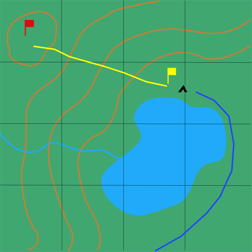
- To place a marker, tap on the map
- To plan a route, long press on the map, then tap along your route, then tap on the Record button
- While route planning, long press on the map to delete the last point
- To keep the map centred at your position, tap on the Follow button
- To keep your route pointing up, tap on the Follow button again
- To mark your current position, tap on the Follow button, wait for a satellite fix, then tap on the Mark button
- To record your movements, tap on the Follow button, then tap on the Record button
- To view a marker's information window, tap on the marker
- To rename or delete a marker, tap on the information window
- To find the flattest route, long press on the start point, then long press on the end point
- Android Wear notifications will be generated when satellite tracking or recording
- Marker detail screen will show geo tagged photos taken within 100 meters of the marker
- Graphs created using the Snowdon graphing library
- Automatic routing created using the A* search algorithm
Trouvez votre chemin dans l'arrière pays avec cet outil de navigation. Voir les cartes, placer des marqueurs, de planifier des itinéraires, voir profils d'altitude et de vitesse, rechercher des itinéraires et des marqueurs, et enregistrer vos mouvements à travers le pays.
- Activer le suivi par satellite dans les paramètres avant de commencer
- Pour placer un marqueur, appuyez sur la carte
- Pour planifier un itinéraire, appuyez longuement sur la carte, puis appuyez sur votre itinéraire, puis appuyez sur le bouton Enregistrer
- Alors que la planification d'itinéraire, appuyez longuement sur la carte pour effacer le dernier point
- Pour garder la carte centrée sur votre position, appuyez sur le bouton Suivre
- Pour garder votre itinéraire vers le haut, appuyez sur le bouton Suivre à nouveau
- Pour marquer votre position actuelle, appuyez sur le bouton Suivre, attendez une solution par satellite, puis appuyez sur le bouton Mark
- Pour enregistrer vos mouvements, appuyez sur le bouton Suivre, puis appuyez sur le bouton Enregistrer
- Pour voir la fenêtre d'information d'un marqueur, appuyez sur le marqueur
- Pour renommer ou supprimer un marqueur, appuyez sur la fenêtre d'information
- Pour trouver l'itinéraire le plus plat, appuyez longuement sur le point de départ, puis appuyez longuement sur le point final
- Notifications d'usure Android seront générés lorsque le suivi par satellite ou l'enregistrement
- Écran de détail de Marker montrera geo tagged photos prises à moins de 100 mètres du marqueur
- Graphiques créée en utilisant la bibliothèque graphique Snowdon
- Routage automatique créée en utilisant l'algorithme A * de recherche
