
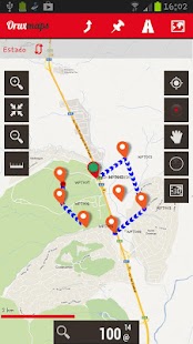
Map viewer, track logger.
You can use OruxMaps for your outdoor activities (running, trekking, mountain bike, paragliding, flying, nautic sports, etc.)
Some permissions explained:
1.-SEND_SMS: For new SOS feature.
2.-GET_ACCOUNTS: For secure login in OruxMaps servers.
3.-READ_CONTACTS: For fast friend selection.
100% free
100% no advertisements
Online and offline maps. Support to multiple formats:
-OruxMaps format. You can use maps from Ozi Explorer transformed with a PC tool.
-.ozf2
-.img garmin (vectorial) - no full support is provided.
-.mbtiles
-.rmap
-.map (vectorial from mapsforge). Support to custom themes similar to Locus themes.
Support to Wms, you can use the application as a WMS viewer.
3D view.
Support to multiple external devices:
-GPS bluetooth.
-Heart rate monitors, bluetooth Zephyr, Polar (including bluetooth smart devices, like polar H7).
-ANT+ (speed, cadence, heart rate, distance, etc.).
-AIS information systems (experimental), for nautical sports, using Wi-fi or bluetooth.
More features:
Support to KML, KMZ and GPX formats.
Share your position with your friends, display the position of your friends on your device.
Download online maps for offline use.
Text to speech support.
Profiles; save your preferences on your SD card.
Statistics with graphics.
Follow routes, with different alarms to alert you if you are near a waypoint, or you are far from the route.
Create/save waypoints, attaching photo/audio/video extensions.
Custom waypoint types, with your icons.
Basic support to Geocaching.
Correct the altitude of your tracks/routes using DEM files (offline) or online services.
Search/download tracks from:
-everytrail.com
-gpsies.com
Search or create tracks offline using Broute app.
Upload tracks to:
-mapmytracks.com
-trainingstagebuch.org
-ikimaps.com
-wikirutas.com
-openxplora.com
-strava.com
-openstreetmaps.org
Live tracking using:
-mapmytracks.com
-okmap application
-gpsgate protocol
More info here: www.oruxmaps.com
지도 뷰어, 트랙 로거.
당신은 당신의 야외 활동 (실행, 트레킹, 산악 자전거, 패러 글라이딩, 비행, NAUTIC 스포츠 등) OruxMaps을 사용할 수 있습니다
일부 권한 설명 :
1.-SEND_SMS : 새로운 SOS 기능하십시오.
2. - GET_ACCOUNTS : OruxMaps 서버에서 보안 로그인하십시오.
3. - READ_CONTACTS : 빠른 친구를 선택하십시오.
100 % 무료
100 % 아니 광고
온라인 및 오프라인지도. 여러 형식에 대한 지원 :
형식을 -OruxMaps. 당신은 PC 도구로 형질 전환 된 Ozi 탐색기에서지도를 사용할 수 있습니다.
-.ozf2
-.img GARMIN (의 vectorial) - 더 완벽하게 지원이 제공되지 않습니다.
-.mbtiles
-.rmap
-.map (mapsforge에서의 vectorial). 로커스 테마와 유사한 사용자 지정 테마에 대한 지원.
WMS에 대한 지원, 당신은 WMS 뷰어로 응용 프로그램을 사용할 수 있습니다.
3D 뷰.
여러 외부 장치 지원 :
- GPS 블루투스.
한 마음 박동 모니터 (극 H7과 같은 블루투스 스마트 기기 포함) 블루투스 제퍼, 폴라.
-ant + (속도, 케이던스, 심박수, 거리 등).
와이파이 또는 블루투스를 사용하여 해상 스포츠에 대한 -AIS 정보 시스템 (실험).
더 많은 기능 :
KML, KMZ과 GPX 포맷을 지원합니다.
친구들과 위치를 공유 장치에서 친구의 위치를 표시합니다.
오프라인 사용을위한 온라인지도를 다운로드합니다.
음성 지원 텍스트입니다.
프로필; 당신의 SD 카드에 기본 설정을 저장합니다.
그래픽 통계.
당신이 웨이 포인트 근처에있는, 또는 당신이 지금까지 경로의 경우 사용자에게 경고하기 위해 다른 경보와 노선을 따르십시오.
사진 / 오디오 / 비디오 확장을 부착, 웨이 포인트를 저장 / 만듭니다.
당신의 아이콘 사용자 정의 웨이 포인트 유형.
지오 캐싱에 대한 기본 지원.
DEM 파일 (오프라인) 또는 온라인 서비스를 사용하여 트랙 / 경로의 고도를 수정합니다.
검색 / 다운로드 트랙에서 :
-everytrail.com
-gpsies.com
검색 또는 오프라인 Broute 앱을 사용하여 트랙을 만들 수 있습니다.
트랙에 업로드 :
-mapmytracks.com
-trainingstagebuch.org
-ikimaps.com
-wikirutas.com
-openxplora.com
-strava.com
-openstreetmaps.org
사용 추적 라이브 :
-mapmytracks.com
-okmap 응용 프로그램
-gpsgate 프로토콜
자세히 알아보기 : www.oruxmaps.com
