
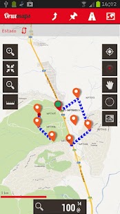
Map viewer, track logger.
You can use OruxMaps for your outdoor activities (running, trekking, mountain bike, paragliding, flying, nautic sports, etc.)
Some permissions explained:
1.-SEND_SMS: For new SOS feature.
2.-GET_ACCOUNTS: For secure login in OruxMaps servers.
3.-READ_CONTACTS: For fast friend selection.
100% free
100% no advertisements
Online and offline maps. Support to multiple formats:
-OruxMaps format. You can use maps from Ozi Explorer transformed with a PC tool.
-.ozf2
-.img garmin (vectorial) - no full support is provided.
-.mbtiles
-.rmap
-.map (vectorial from mapsforge). Support to custom themes similar to Locus themes.
Support to Wms, you can use the application as a WMS viewer.
3D view.
Support to multiple external devices:
-GPS bluetooth.
-Heart rate monitors, bluetooth Zephyr, Polar (including bluetooth smart devices, like polar H7).
-ANT+ (speed, cadence, heart rate, distance, etc.).
-AIS information systems (experimental), for nautical sports, using Wi-fi or bluetooth.
More features:
Support to KML, KMZ and GPX formats.
Share your position with your friends, display the position of your friends on your device.
Download online maps for offline use.
Text to speech support.
Profiles; save your preferences on your SD card.
Statistics with graphics.
Follow routes, with different alarms to alert you if you are near a waypoint, or you are far from the route.
Create/save waypoints, attaching photo/audio/video extensions.
Custom waypoint types, with your icons.
Basic support to Geocaching.
Correct the altitude of your tracks/routes using DEM files (offline) or online services.
Search/download tracks from:
-everytrail.com
-gpsies.com
Search or create tracks offline using Broute app.
Upload tracks to:
-mapmytracks.com
-trainingstagebuch.org
-ikimaps.com
-wikirutas.com
-openxplora.com
-strava.com
-openstreetmaps.org
Live tracking using:
-mapmytracks.com
-okmap application
-gpsgate protocol
More info here: www.oruxmaps.com
地図ビューア、トラックロガー。
あなたはあなたの屋外活動(ランニング、トレッキング、マウンテンバイク、パラグライダー、飛行、ノーティックスポーツなど)のためOruxMapsのを使用することができます
いくつかの権限は説明しました:
1.-SEND_SMS:新SOS機能について。
2.-GET_ACCOUNTS:OruxMapsのサーバではセキュアなログインのために。
3.-READ_CONTACTS:高速友人の選択のために。
100%無料
100%広告なし
オンラインとオフラインのマップ。複数のフォーマットへのサポート:
-OruxMaps形式。あなたは、PCツールで形質転換OZIエクスプローラからマップを使用することができます。
-.ozf2
-.imgガーミン(ベクトル) - 何の完全なサポートが提供されていません。
-.mbtiles
-.rmap
-.map(mapsforgeからベクトル)。軌跡のテーマに似たカスタムテーマをサポート。
WMSへの支援は、WMSビューアなどのアプリケーションを使用することができます。
3Dビュー。
複数の外部機器へのサポート:
-GPSブルートゥース。
-Heartレートモニター、(極性H7のようなブルートゥーススマートデバイスを含む)ブルートゥースゼファー、極地。
-ANT +(速度、ケイデンス、心拍数、距離、等)。
Wi-FiまたはBluetoothを使用して、航海スポーツのための情報システム(実験)を、-AIS。
その他の特長:
KML、KMZおよびGPX形式にサポート。
お友達と自分の位置を共有し、あなたのデバイス上であなたの友人の位置を表示します。
オフラインで使用するために、オンラインマップをダウンロードしてください。
音声サポートへのテキスト。
プロファイル;あなたのSDカードに設定を保存。
グラフィックスと統計。
あなたはウェイポイントの近くにある、またはあなたが遠くルートからある場合にアラートを受信するために、異なるアラームで、ルートに従ってください。
写真/音声/ビデオ拡張を取り付け、ウェイポイントを保存/作成します。
あなたのアイコンでカスタムウェイポイントの種類、。
ジオキャッシングの基本的なサポート。
DEMファイル(オフライン)、またはオンラインサービスを使用して、あなたのトラック/ルートの標高を修正してください。
検索/ダウンロードトラックから:
-everytrail.com
-gpsies.com
検索またはオフラインBrouteアプリを使ってトラックを作成します。
にトラックをアップロードします:
-mapmytracks.com
-trainingstagebuch.org
-ikimaps.com
-wikirutas.com
-openxplora.com
-strava.com
-openstreetmaps.org
使用して追跡するライブ:
-mapmytracks.com
-okmapアプリケーション
-gpsgateプロトコル
詳細:www.oruxmaps.com
